New Google Earth Time-lapse Feature Shows The Damage Humans Made To The Planet Since 1984
No matter how you feel about it, the Earth is changing.
Google created a new way to look at different snapshots of the Earth any year from 1984 to 2020 using their Google Earth Time-lapse. For this project, Google partnered with government agencies like NASA, the Geological Survey, and the European Space Agency.
The tool uses over 24 million satellite photos to show how nature has changed over time. These photos show the clear difference between 1984 and 2020 attributed to human activity.
Despite the overwhelming evidence that climate change is real, there are plenty of skeptics. There have been some advancements toward a greener Earth, but much more needs to be done in order to protect our only planet. However you personally feel about the cause, the reality is that climate and the landscape has changed and will continue to change.
Read more about the tool here.
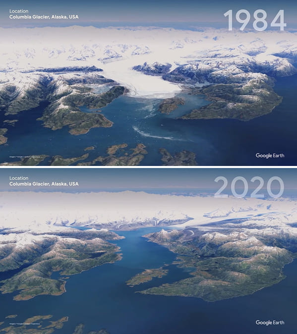
1. Columbia Glacier, Alaska, USA
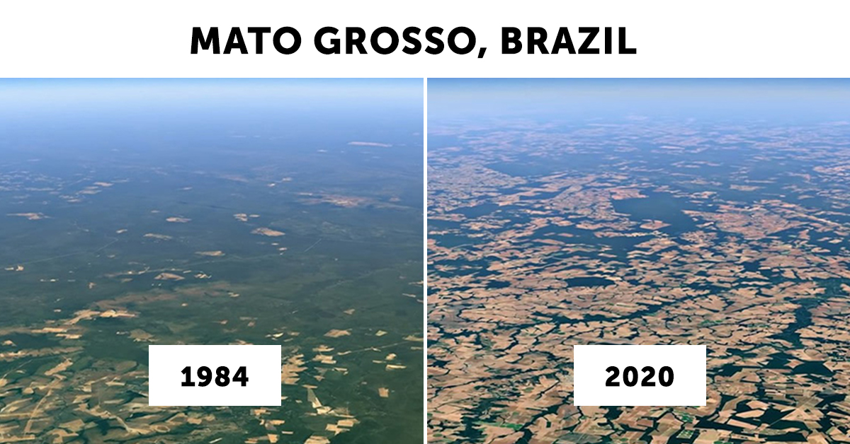
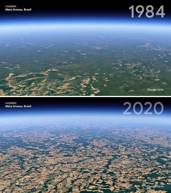
2. Mato Grosso, Brazil
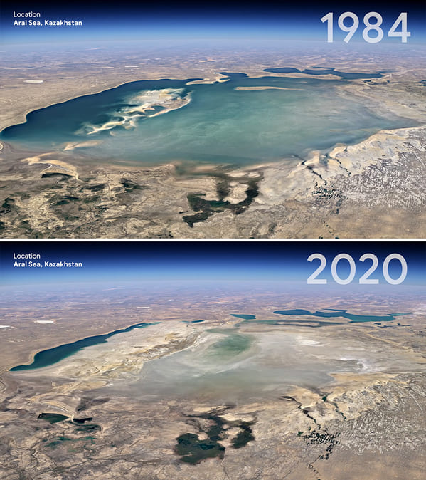
3. Aral Sea, Kazakhstan
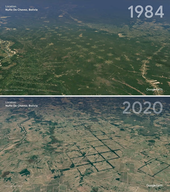
4. Nuflo De Chavez, Bolivia
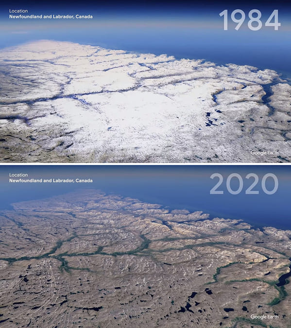
5. Newfoundland And Labrador, Canada
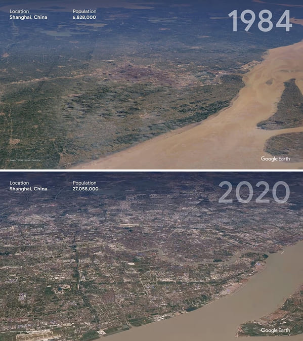
6. Shanghai, China
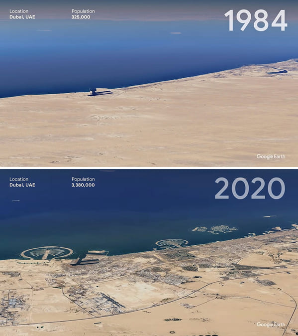
7. Dubai, Uae
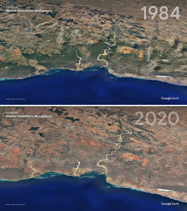
8. Atsimo-Andrefana, Madagascar
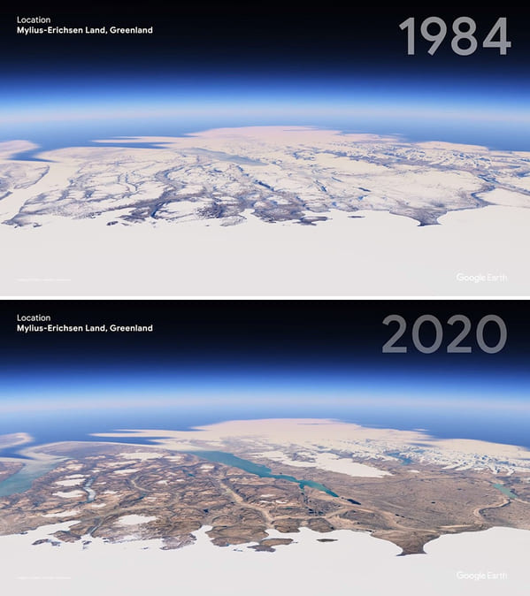
9. Mylius-Erichsen Land, Greenland
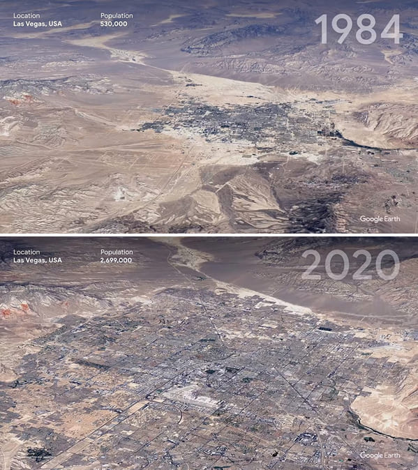
10. Las Vegas, USA
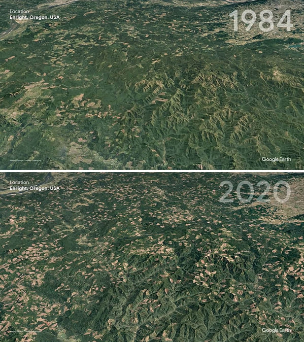
11. Enright, Oregon, USA
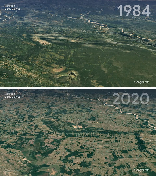
12. Sara, Bolivia
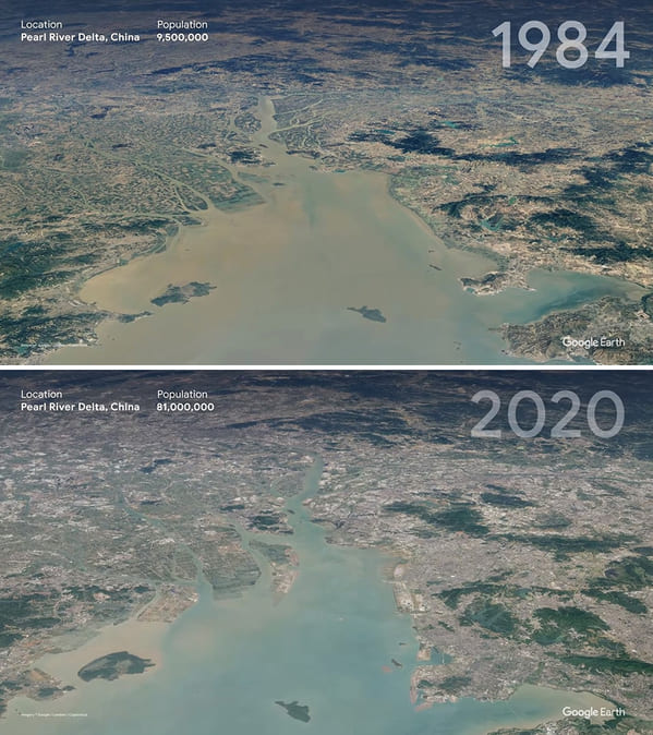
13. Pearl River Delta, China
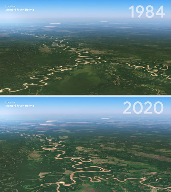
14. Mamore River, Bolivia
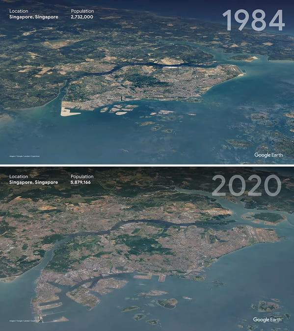
15. Singapore
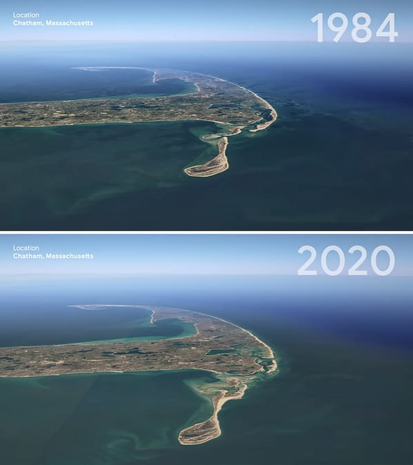
16. Chatham, Massachusetts